Mundra Fm
Type Locality and Naming
SUBSURFACE. Interval 2415-3055m in well SP-1-1. [Original Publication: Zutshi, P.L., Mittal, S.K and Shah, L. (1993) Lithostratigraphy of Indian Petroliferous Basins, Document IV, Kutch Saurashtra Basin, KDMIPE, ONGC Publication, pp 1-50.]
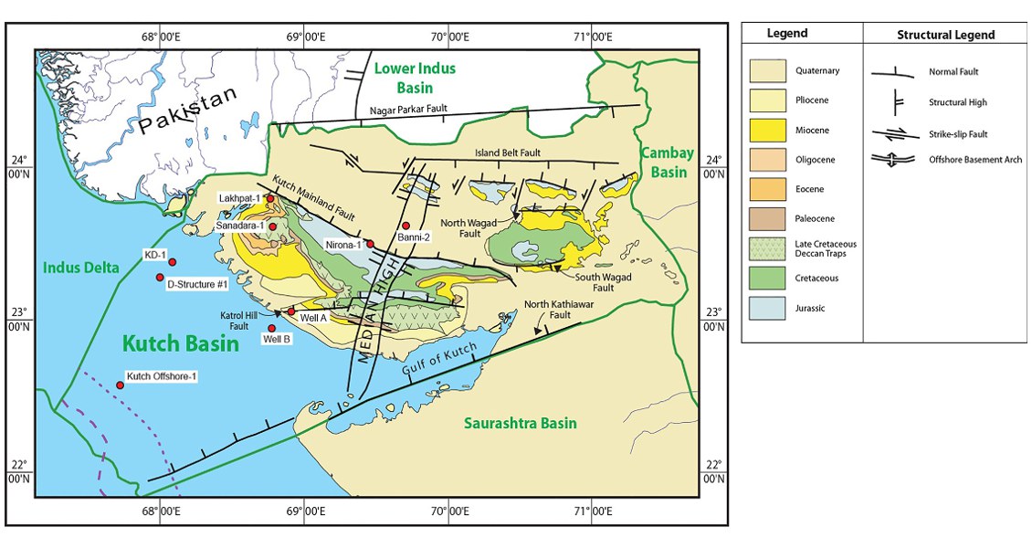
[Fig. Geological and structural map of Kutch, also showing the onshore and offshore wells drilled for oil exploration. (Map by Rasoul Sorkhabi in GeoExpro Dec2014, based on various sources including S.K. Biswas, Current Science, 25May2005)]
Lithology and Thickness
Clayey sandstone and Basalt. It consists of sandstone, laminated shale, carbonaceous streaks and thin basalt flows. 640 m in the well SP-1-1.
Relationships and Distribution
Lower contact
Unconformable with Bhuj Fm, it is marked by occurrences of thin basaltic flows
Upper contact
Disconformable with Deccan Traps Fm.
Regional extent
GeoJSON
Fossils
Nannoplanktons like Watznaueria cf. barnesae w.cf.bayacki
Age
Depositional setting
Continental to shallow marine
Additional Information
